• Welcome Visitor! Please take a few seconds and Register for our forum. Even if you don't want to post, you can still 'Like' and react to posts.

Nav question


James Morse

1997 XLT 4.0L 4x4 1999 Mazda B3000 2wd
Supporting Member
Joined
Aug 31, 2021
Messages
1,891
Reaction score
974
Points
113
Location
Roanoke VA
Vehicle Year
1997 and 1999
Make / Model
XLT 4x4 & B3000
Engine Type
4.0 V6
Engine Size
4.0L in XLT, 3.0L in B3000
Transmission
Automatic
2WD / 4WD
4WD
Tire Size
31x10.5-15 K02's on the Ranger, 235/75R15 on Mazda
My credo
The perfect is the enemy of the good.
Google maps works pretty well but if I set a destination then don't make it there I want to change my destination to home or whatever. The problem is even though I still have GPS, without cell service I can't reset my destination. I can look at a paper map and look at where I am on the Google map and try to reconcile them but what a pain. Is there a solution to this?


tinman_72

Active Member
Joined
Apr 14, 2008
Messages
532
Reaction score
136
Points
43
Location
North Georgia
Vehicle Year
1993
Make / Model
Ford
Engine Type
2.5 (4 Cylinder)
Engine Size
2.5
Transmission
Manual
2WD / 4WD
2WD
Total Lift
Factory
Total Drop
None
Tire Size
255/60R15
My credo
RoHS compliant
Look through the settings for something to the effect of "offline maps". It allows you to download maps for frequently used regions to be used even when out of range.
 

ericbphoto

Overlander in development
TRS Event Staff
TRS Forum Moderator
Supporting Member
U.S. Military - Veteran
TRS 20th Anniversary
VAGABOND
TRS Event Participant
GMRS Radio License
Joined
Feb 7, 2016
Messages
15,338
Reaction score
16,598
Points
113
Age
59
Location
Wellford, SC
Vehicle Year
1993
Make / Model
Ford Ranger
Engine Type
3.0 V6
Engine Size
3.0L
Transmission
Manual
2WD / 4WD
4WD
Total Lift
6"
Tire Size
35"
My credo
In theory, theory and practice are the same. In practice, they are different.
Yeah. Like Tinman said. You have to download maps for the area you’ll be traveling and save them to the device for offline use. It’s not just Google maps. You have to do the same for whatever navigation app you’re using. GPS keeps track of where you are. But the graphical maps that we need to look at and that the app uses to calculate your track, all come over the cell signal. You lose cell signal (only a few hundred feet high and easily blocked by terrain) much easier and more frequently than GPS signal (comes out if the sky from a satellite).
 
Last edited:

scotts90ranger

Well-Known Member
RBV's on Boost
Joined
Feb 28, 2001
Messages
8,038
Reaction score
4,373
Points
113
Location
Dayton Oregon
Vehicle Year
1990, 1997
Make / Model
Ford
Engine Type
2.3 (4 Cylinder)
Engine Size
2.3 Turbo
Transmission
Manual
2WD / 4WD
4WD
Total Lift
6
Tire Size
35"
And this is why I have $20 second or so hand Garmin units on hand... there's more cell towers and reception around anymore but there's still dead spots...
 

ericbphoto

Overlander in development
TRS Event Staff
TRS Forum Moderator
Supporting Member
U.S. Military - Veteran
TRS 20th Anniversary
VAGABOND
TRS Event Participant
GMRS Radio License
Joined
Feb 7, 2016
Messages
15,338
Reaction score
16,598
Points
113
Age
59
Location
Wellford, SC
Vehicle Year
1993
Make / Model
Ford Ranger
Engine Type
3.0 V6
Engine Size
3.0L
Transmission
Manual
2WD / 4WD
4WD
Total Lift
6"
Tire Size
35"
My credo
In theory, theory and practice are the same. In practice, they are different.
And this is why I have $20 second or so hand Garmin units on hand... there's more cell towers and reception around anymore but there's still dead spots...
Lots of dead spots in the mountains around me. And, I’m sure it’s a lot worse out west when you get away from main highways when overlanding and 4- wheeling.
 

scotts90ranger

Well-Known Member
RBV's on Boost
Joined
Feb 28, 2001
Messages
8,038
Reaction score
4,373
Points
113
Location
Dayton Oregon
Vehicle Year
1990, 1997
Make / Model
Ford
Engine Type
2.3 (4 Cylinder)
Engine Size
2.3 Turbo
Transmission
Manual
2WD / 4WD
4WD
Total Lift
6
Tire Size
35"
Yeah, on many mountain passes around here at least in the Cascades there's ski slopes and other stuff so there are towers around (you know, to keep the yuppy kids entertained mostly I imagine) but if you get off the beaten path it's really spotty... Not too bad on the I5 corridor but on the east side of the state is different...
 

sgtsandman

Aircraft Fuel Tank Diver
TRS Forum Moderator
U.S. Military - Active
TRS 20th Anniversary
TRS Event Participant
Ham Radio Operator
GMRS Radio License
Joined
Mar 11, 2017
Messages
12,861
Reaction score
12,651
Points
113
Location
Aliquippa, PA
Vehicle Year
2011/2019
Make / Model
Ranger XLT/FX4
Engine Size
4.0 SOHC/2.3 Ecoboost
2WD / 4WD
4WD
Total Lift
Pre-2008 lift/Stock
Tire Size
31X10.5R15/265/65R17
The downloadable maps is a good start. It might be worth your while to get an inexpensive tablet and install a app like Gaia or ON X. They have one with GPS capability.

You could still use your phone and the tablet would give a different perspective with the app and redundancy.

Paper maps are always a good backup that never runs out of batteries or any kind of signal.

Conversely, a dedicated GPS unit with off road oriented maps is best. Some GPS units have a slot for microSD cards for that and are way less expensive than a dedicated off road GPS unit.
 

ericbphoto

Overlander in development
TRS Event Staff
TRS Forum Moderator
Supporting Member
U.S. Military - Veteran
TRS 20th Anniversary
VAGABOND
TRS Event Participant
GMRS Radio License
Joined
Feb 7, 2016
Messages
15,338
Reaction score
16,598
Points
113
Age
59
Location
Wellford, SC
Vehicle Year
1993
Make / Model
Ford Ranger
Engine Type
3.0 V6
Engine Size
3.0L
Transmission
Manual
2WD / 4WD
4WD
Total Lift
6"
Tire Size
35"
My credo
In theory, theory and practice are the same. In practice, they are different.
The downloadable maps is a good start. It might be worth your while to get an inexpensive tablet and install a app like Gaia or ON X. They have one with GPS capability.

You could still use your phone and the tablet would give a different perspective with the app and redundancy.

Paper maps are always a good backup that never runs out of batteries or any kind of signal.

Conversely, a dedicated GPS unit with off road oriented maps is best. Some GPS units have a slot for microSD cards for that and are way less expensive than a dedicated off road GPS unit.
Even with apps like Gaia and onxoffroad, you need to download maps for offline use.
 

sgtsandman

Aircraft Fuel Tank Diver
TRS Forum Moderator
U.S. Military - Active
TRS 20th Anniversary
TRS Event Participant
Ham Radio Operator
GMRS Radio License
Joined
Mar 11, 2017
Messages
12,861
Reaction score
12,651
Points
113
Location
Aliquippa, PA
Vehicle Year
2011/2019
Make / Model
Ranger XLT/FX4
Engine Size
4.0 SOHC/2.3 Ecoboost
2WD / 4WD
4WD
Total Lift
Pre-2008 lift/Stock
Tire Size
31X10.5R15/265/65R17
Even with apps like Gaia and onxoffroad, you need to download maps for offline use.
That what I intended to say but failed I guess. Thanks for making sure James knows that.
 

ericbphoto

Overlander in development
TRS Event Staff
TRS Forum Moderator
Supporting Member
U.S. Military - Veteran
TRS 20th Anniversary
VAGABOND
TRS Event Participant
GMRS Radio License
Joined
Feb 7, 2016
Messages
15,338
Reaction score
16,598
Points
113
Age
59
Location
Wellford, SC
Vehicle Year
1993
Make / Model
Ford Ranger
Engine Type
3.0 V6
Engine Size
3.0L
Transmission
Manual
2WD / 4WD
4WD
Total Lift
6"
Tire Size
35"
My credo
In theory, theory and practice are the same. In practice, they are different.
I miss paper maps. Really kind of enjoyed using the one I had at LBL. But it’s awesome when you know from the paper map that there is a left turn coming up. So, you look at the screen and it shows your little icon approaching an intersection.
 

gaz

Well-Known Member
U.S. Military - Veteran
Joined
Sep 21, 2007
Messages
1,425
Reaction score
657
Points
113
Location
Wa, Bremerton 98310
Vehicle Year
1987
Make / Model
Ford
Engine Size
87Ranger Endrigo 2.9l, 87BII Endrigo 4.0l
2WD / 4WD
4WD
Total Lift
Ranger 5" (2" suspension), BII 4" suspension
Total Drop
Ranger 5sp, BII A4LD
Tire Size
Ranger 33"/4:10LS, BII 29"/3:73LS
My credo
Deengineer until it is how Blue Oval should have sold it!!
I only use paper maps. I plan my route before departure, recorded in a 3x5 notebook.
 
Last edited:

James Morse

1997 XLT 4.0L 4x4 1999 Mazda B3000 2wd
Supporting Member
Joined
Aug 31, 2021
Messages
1,891
Reaction score
974
Points
113
Location
Roanoke VA
Vehicle Year
1997 and 1999
Make / Model
XLT 4x4 & B3000
Engine Type
4.0 V6
Engine Size
4.0L in XLT, 3.0L in B3000
Transmission
Automatic
2WD / 4WD
4WD
Tire Size
31x10.5-15 K02's on the Ranger, 235/75R15 on Mazda
My credo
The perfect is the enemy of the good.
I guess I should have said what I do now. First I look at a map of the whole area and see all kinds of Nat'l Forest. Then I ask, what is close to me (say w/in an hour).
Each Nat'l Forest has a pocket map that shows the different Districts and where is the ranger station for it. Then what I want is the District map, that will have (as far as one assumes they are up to date) all the F.S. roads on it and other nice info. Some maps have topo if they don't I have other maps for that. So I can know beforehand, what looks like it might be interesting and where there are huge changes in elevation because you -know- that's going to be steep. Most of the roads go up because they are there for the fire crews to get there. Speaking of which we have a lot of wildfire right now the atmosphere is "unhealthy" my eyes were watering last night.
Some roads follow creeks so there it tends to be water and maybe mud but those aren't so common.
There's also online F.S. vehicle-use maps (pdf).

Once I decide, ok, I'm going to try going to some spot, I like to have a backup plan, because sometimes you get there and the road is gated. But usually there's other options close of places to go even if it's not offroading there are things to do and see for an outing. I don't like to drive somewhere then go, oh, it's blocked, let's go home. Nah.

I try to call the ranger for the district so far not lots of luck with that. I was hoping they might tell me condition of roads, who knows. I suppose part of the doing of it is finding out. Some places like Potts Mt road you just know from various sources, you will need basically a rock crawler to get through there.

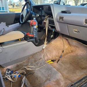
I also look at Google maps and Google earth 3D as part of it. But I don't go somewhere and not have paper maps and a compass and so far I never didn't know where I was. I do really like the GPS showing me exactly, which I have, but I can't reset destinations / waypoints because Google maps is online software and I haven't tried the offline maps saving yet so that's the next thing.

Probably I'm not eager to spend $3k on a nav system and looks like way overkill for me. I think I'd get the Xoffroad app, not expensive, and you can get all the property lines so I'd know definitely when I'm on the forest. I realize you still have to download the maps for offline use but I'd think once you've done that, that since the app is resident on the phone/tablet vs on a server somewhere, you'd be able to reset destination.
 

sgtsandman

Aircraft Fuel Tank Diver
TRS Forum Moderator
U.S. Military - Active
TRS 20th Anniversary
TRS Event Participant
Ham Radio Operator
GMRS Radio License
Joined
Mar 11, 2017
Messages
12,861
Reaction score
12,651
Points
113
Location
Aliquippa, PA
Vehicle Year
2011/2019
Make / Model
Ranger XLT/FX4
Engine Size
4.0 SOHC/2.3 Ecoboost
2WD / 4WD
4WD
Total Lift
Pre-2008 lift/Stock
Tire Size
31X10.5R15/265/65R17
OnX Off Road is a good resource as is Gaia. Best Buy has Samsung Tablets with somewhat decent internal memory and GPS. I’m looking one that is about 8” corner to corner.

Paper maps, the ranger station is probably going to be your best bet. USGS is going to be the next best but the maps are big and not laid out based on where you want to go. So you may need more than one and will have to order them.


Blmpkn

Toilet enthusiast
Supporting Member
Joined
Feb 15, 2020
Messages
5,503
Reaction score
6,359
Points
113
Location
Southern maine
Vehicle Year
2023
Make / Model
Ford Bronco
Engine Type
2.3 EcoBoost
Engine Size
2.3
Transmission
Automatic
2WD / 4WD
4WD
Total Lift
2.5"
Tire Size
285/75/18
My credo
Its probably better to be self deprecating than self defecating.
I bought a relatively cheap Magellan offroad GPS a few years ago.. it's certainly not as refined and fancy as Garmins 'overlander' GPS.. but its absolutely worth it for 1/3 the price and for how much I use it.
 

James Morse

1997 XLT 4.0L 4x4 1999 Mazda B3000 2wd
Supporting Member
Joined
Aug 31, 2021
Messages
1,891
Reaction score
974
Points
113
Location
Roanoke VA
Vehicle Year
1997 and 1999
Make / Model
XLT 4x4 & B3000
Engine Type
4.0 V6
Engine Size
4.0L in XLT, 3.0L in B3000
Transmission
Automatic
2WD / 4WD
4WD
Tire Size
31x10.5-15 K02's on the Ranger, 235/75R15 on Mazda
My credo
The perfect is the enemy of the good.
Thanks. Seems like a lot of USGS maps are really old, I looked at Bald Mt and there were no roads at all there. Unless I missed something. But they do have the great topo.

Will check out Samsung and Magellan.

So with those, if I download offline maps, then I can change my destination on the fly (with no cell service), as long as GPS is still working, right?
Now if I can do that with Google offline maps I'd actually be pretty well set (something I can try I guess - download a map, then turn off network which should leave me with only GPS and see if it works).
 

Sponsored Ad


Sponsored Ad

Staff online

Member & Vendor Upgrades

For a small yearly donation, you can support this forum and receive a 'Supporting Member' banner, or become a 'Supporting Vendor' and promote your products here. Click the banner to find out how.

Truck of The Month


Shran
April Truck of The Month

Recently Featured

Want to see your truck here? Share your photos and details in the forum.

Follow TRS On Instagram

TRS Events

25th Anniversary Sponsors

Check Out The TRS Store


Sponsored Ad


Sponsored Ad

Sponsored Ad


Amazon Deals

Top